
*Tv-release*
Active Member
File size: 7.0 MB
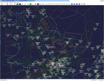
PlanePlotter receives and decodes live digital position reports from aircraft and plots them on a chart. Using PlanePlotter, you can see a radar-like display of all those aircraft around you that are transmitting the appropriate digital messages including ACARS, ADS-B and HFDL.
PlanePlotter - Features
The animated screen grab from PlanePlotter (left) was kindly provided by John Locker.
Message display
PlanePlotter shows a table display of messages received and decoded from live aircraft transmissions.
Data saving
PlanePlotter archives all the digital data that it receives and decodes to a log file.
Chart display
Google Earth server
If you are receiving Mode-S ADS-B position reports, PlanePlotter can interface to Google Earth to display aircraft positions over the Google Earth base map. It can even give you a dynamic real-time view from the flight deck of an aircraft that you designate.
Direction finding
PlanePlotter can determine and display the direction of any transmission using a simple passive antenna switch. This allows aircraft to be located even if they are not equipped with ACARS or Mode-S/ADS-B.
Whats New
Updates: official site does not provide any info about changes in this version.
Homepage:
Download Links
Rapidgator
uploadgig
1